IUCN/SCC Otter Specialist Group Bulletin
©IUCN/SCC Otter Specialist Group
Volume 23 Issue 1 Pages 1 - 48 (April 2006)
Citation: Georgiev, D.G. & Stoycheva, S. (2006) Habitats, Distribution and Population Density Otter Survey in the Western Rhodopes Mountains (Southern Bulgaria) IUCN Otter Spec. Group Bull. 23 (1): 36 - 43
Previous | Contents | Next
Habitats, Distribution and Population Density Otter Survey in the Western Rhodopes Mountains (Southern Bulgaria)
Dilian G. Georgiev1 and Slaveya Stoycheva2
1Department of Ecology and Environmental Conservation, University of Plovdiv, Tzar Assen Str. 24,BG-4000 Plovdiv, Bulgaria. Email: diliangeorgiev@abv.bg, dgeorgiev@greenbalkans.org
2NGO Green Balkans, Shesti Septemvri Str. 160BG-4000, Plovdiv, Bulgaria Email: slaveyastoycheva@abv.bg
|
 |
 |
Abstract: The aim of our study was to investigate the otter habitats, their conditions in the Rhodopes Mountains (Bulgaria) and the effect on the otter distribution and population density. The investigation was carried out during the period 2004-2006.
The continually used (core) habitats were: 1. large high mountain dams combined with headstreams. These were all at altitudes above 1000 meters. The effect of ecotone between the two habitats (dams and headstreams) ensures food supply, shelter and space throughout the year. The otter was found in all such dams in the Western Rhodopes: Golyam Beglik, Shiroka Polyana and Batak. When all the bankside of Golyam Beglik Dam (21.8 km) was searched, only one possible resident female was found. On Batak Dam (30.0 km), there were three possible resident females and one adult male; 2. Medium sized rivers. The otter was found in all such rivers in the Rhodopes. On a stretch of Chaya River between Jugovsko Hanche and Asenovgrad Town (14.5 km), two possible resident females, one adult and one sub-adult male, were recorded. On the Parvenetzka River, there were 2 possible resident female otters per 24 river kilometres; 3. Large Dams with steep banks in the lower parts of the mountain. The otter was found at Dospat Dam; no data for the population density was estimated.
Temporarily used habitats and bank vegetation associations were also assessed according to their usage by the otters in the area and their conservation status. |
INTRODUCTION
The ecology of the otter in Bulgaria has been little known (PESHEV et al., 2004). Recommendations for detailed research were made by SPIRIDONOV and SPASSOV (1989) and SPIRIDONOV and MILEVA (1994). The conservation of the unique ecosystems in the Western Rhodopes Mountain is now underway. Data for otters in the Greek part of the mountain was presented by MACDONALD and MASON (1982, 1985). The otter is the top predator in the wetlands and is often highlighted as an indicator for the condition of whole river catchments (CHANIN, 2003). While studying otter ecology and conservation we gained data for the conservation of running and still waters in the area. The aim of our study was to investigate otter habitats in the Rhodopes Mountain and their effects on the population density.
MATERIALS AND METHODS
The investigation was carried out in 2004-2006. Between March and October 2006 the study was financed by the Scientific and Applied Activities Section of the Scientific Research Fund of Plovdiv University “Paisii Hilendarski”. Previous trips were financed by various projects of NGO Green Balkans, especially for studying the Natura 2000 - rivers as potential bio corridors in Rhodopes Mountain, in a relation with the preliminary investigations for building up the Bulgarian part of the European Ecological Network. Some data from these travels (these one carried out in 2004 and at the beginning of 2005) has already been published by GEORGIEV (2005), and is summarized here, together with data from our new studies (during the second half of 2005 and 2006). Throughout all of the otter investigations a number of identical methods were used.
A total of 147 kilometers of bank were walked:
- Rivers – Ravnogorska (4.1); Pavlitza (1.0); Below Snejanka Cave (2.5); Parvenetzka (1.0); Stara (2.6); Chaya (14.5); a river parallel to the road from Batak Town to Dospat Town (3.0); a river flowing to Toshkov Chark Dam (3.0); tributary to Vacha River between village of Osenovo and Krichim Town (3.0); Dospat; Lepenitza; Ludi Dol; Mostovska Sushica; Bistritza; Chaya headstream; Malka Arda; Vacha; Devinska; Cherna; Manastirska (5 km routes covered on all these rivers).
- Lakes – near Momchil Yunak Hut; group of Smolyanski Lakes;
- Micro dams – Beglika Dam (1.0);
- Large Dams (the whole bank side was walked) - Batak (30.0) and Golyam Beglik (21.8). (Figure 1).
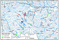 |
| Figure 1. Study area |
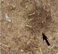
The otter distribution was studied by the “standard” method of MACDONALD and MASON (1983) and a questionnaire of relevant people also carried out for extra areas and stretches. The otter’s population density was estimated by track measuring (JENKINS, 1980; SIDOROVICH, 1991; OTTINO and GILLER, 2004), and sex determination according to the positioning of the urine towards the spraint (SIDOROVICH, 1995) only when was deposited on a horizontal plane surface (Figures 2 and 3). When the footprints were measured the specific substrates (mud, sand or wet soil) on which they were made was also considered as a factor for their size. The tracking was combined with home range boundaries localization when accumulation of great numbers of spraints (ERLINGE, 1967, 1968) on exposed places was registered (shelter sprainting sites like under rocks or bridge areas were ignored) or mounds of sand and soil made by otters (VSHIVCEV, 1972; MASON and MACDONALD, 1986). Such sites around dens or evidently favourable hunting sites (pools, dykes and others) were not considered, knowing that they sometimes are also marked such way (VSHIVCEV, 1972; KRUUK, 1995; LILES, 2003). Actually it was concluded that it is a certain home range boundary when after the possible overlap area the size of the tracks differed by size from those found on the previous bank section. For a more precise interpretation of the home range situation information from radio-tracking studies was also looked upon (GREEN et al., 1984; RUIZ-OLMO et al., 1995; DURBIN, 1996). All of the investigations were carried out during the warm seasons (late spring, summer and early autumn), all of the stretches were walked for a day, except the bank sides of Chaia River, Goliam Beglik and Batak Dams which were covered for two consecutive days, and no extra volunteers were working except the authors.
 |
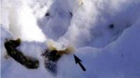 |
Figure 2.
The position of the urine (pointed
by an arrow) is far ahead from the
spraint when deposited by a male otter. Photo: D. Georgiev. Click on image for larger version |
Figure 3.
The position of the urine (pointed by an arrow) is over or very close to the spraint when deposited by a female otter.Photo: D. Georgiev. Click on image for larger version |
According to GEORGIEV (2005) the habitats were considered as continually used (core) and temporarily used subsidiary habitats by their existence during the year and their visible carrying capacity like size and food base. The first ones were with relatively constant environmental conditions, and providing food and shelter for the otters during the whole seasons, but the second did it only during a part of the year or was with evidently poor food base (polluted or over fished waters) and was visited sporadically by otters. The water basins were classified as still and running waters and their water capacity and flow rate was considered by SIDOROVICH (1995). We also noted down and the banks’ vegetation associations used by otters as an important habitat components (MACDONALD and MASON, 1982, 1985), considering also the classifications of Directive 92/43/EEC according the standard ecological principles regarding the dominant plant species (GANEVA et al., 2005).
A GPS (E-Trex Summit) and a digital camera (Olympus) were used to locate and measure routes, transects and to record various important findings on the terrain.
RESULTS AND DISCUSSION
- Continually used (core) habitats. These habitats were considered as basic for the otter population monitoring.
- Large high mountain dams combined with headstreams. These were all at altitudes above 1000 meters. They could be divided into two types: dams with steep banks (Golyam Beglik Dam) or with flattened banks (Batak Dam). This combination of habitats was essential for otter survival at highest altitude levels. The effect of ecotone between the two habitats ensures food supply, shelter and space throughout the year. The otter was found in all such dams in Western Rhodopes: Golyam Beglik, Shiroka Polyana and Batak. The highest point with otter signs was Golyam Beglik at 1545 meters and GPS coordinates N41˚ 49` 04.1`` E24˚ 04` 25.2`` The population density on the dams’ bank sides was very low and the otter presence was always associated with headstream inflows. When all the bankside of Golyam Beglik Dam (21.8 km) was searched, only one possible resident female was found. On Batak Dam (30.0 km), there were three possible resident females and one adult male.
- Medium sized rivers. The otter was found in all such rivers in the Rhodopes: Chaya, Vacha, Parvenetzka, Devinska, Bistritza and Dospat. At a stretch of Chaya River between Jugovsko Hanche and Asenovgrad Town (14.5 km) two possible resident females, one adult and one sub-adult male were recorded. In Parvenetzka River, there were 2 possible resident female otters per about 24 river kilometers. This river was smaller and situated on the north slope of the mountain. The home range of one of the otters was situated partly in the plain, so if this fact is considered, we found a very low population density.
- Large Dams with steep banks in the lower parts of the mountain. The otter was found at Dospat Dam. There is no information on the population density but an otter conservation project is now in progress there and useful results are expected (Yanislav Yanchev, pers. comm.). Data from other similar dams in Kazanlashka Valley (Koprinka and Jrebchevo Dams) situated in Central Bulgaria showed a relative density of about one possible resident female otter per 3-5 kilometres bank line.
- Temporarily used subsidiary habitats.
- Small rivers, headstreams of medium sized rivers and streams. Most of them were described by GEORGIEV (2005). They are: Ravnogorska, Pavlitza, Under Snejanka Cave, a river parallel to the road from Batak Town to Dospat Town, inflow to Toshkov Chark Dam, tributary to Vacha River between village of Osenovo and Krichim Town, Lepenitza, Ludi Dol, Mostovska Sushitza headstream, Chaya headstream, Malka Arda headstream, Davidkovska, Vacha, Devinska headstream, Cherna and Manastirska Rivers. The only footprints found were of a subadult animal on the Malka Arda, near the village of Petkovo.
- Micro dams of medium size. Micro dams are uncommon in the mountains. In contrast with the plains of southern Bulgaria, where the otters inhabit dams almost all year, in the Rhodopes Mountains the situation was different. Unfavourable conditions such as long term freezing in winter and drying in summer. The presence of otters here is strongly influenced by the proximity of “core habitat” such as a medium sized river. An otter family (female with cubs) was found at the river associated with Beglika Dam.
- Mountain lakes. The otter was not found in the group of Smolyanski Lakes and also those near the Momchil Yunak Hut, so they were not included in the paper of GEORGIEV (2005). However the otter is found occasionally in such habitats in Byelorussia (SIDOROVICH, 1995).
- Otter habitats’ components: vegetation associations used by otters. The codes of the habitats with a conservation status considered according the Directive 92/43/EEC were marked.
| Click on images for larger version. All photos were made by the authors. |
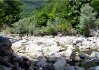
1. Forests: River bank forests dominated by Salix spp., with sub-dominants as Ulmus spp. and Populus spp. An otter den was found at Chaya River in a root system of Salix alba. Habitat code 92A0 |
|
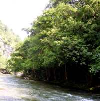
2. Forests: River bank forests dominated by Alnus glutinosa. At the Chaya River using of the root systems as a shelter was registered. In Kazanlashka Valley, Central Bulgaria (Radovo River) an otter den was placed in the roots of A. glutinosa. Use of this habitat was also recorded in Strandza Mountain (Spassov, pers. comm.). |
|
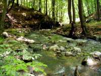
3. Forests: Fagus sylvatica forests. Otter using the habitat recorded on Devinska River. In Sredna Gora Mountain, near the village of Starosel an otter den was found in the root system of a beech-tree. |
|
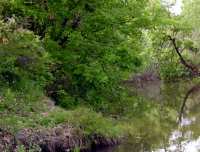
4. Forests: Quercus spp. forests. Mainly used in the smaller mountains and in the plains (Sakar, Sredna Gora, Upper Thracian Valley and other regions) and in the low altitude regions of Rhodopes. Dens were found often in oak root systems. |
|
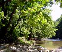
5. Forests: River bank forests dominated by Platanus orientalis. The roots were used for marking on by otters on the Chaya and Parvenetzka Rivers. |
|
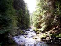
6. Forests: Picea abies forests, with sub-dominants often as Pinus nigra and Pinus sylvestris. Footprints of otters were found on such banks of rivers associated with Golyam Beglik and Beglika dams. Habitat code 9410. |
|
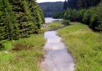
7. Forests: Flooded forests dominated by Picea abies and Pinus sylvestris. Otter tracks in such forests were recorded at the banks of Golyam Beglik Dam. Habitat code 91D0. |
|
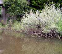
8. Shrub vegetation. Often the dominants were Salix spp., Rubus spp., Rubus idaeus, Cornus spp. and Prunus spinosa. Very important habitat as an otter shelter. The otter sprainting sites were often associated with the shrub vegetation on Parvenetzka and Chaya Rivers. |
|
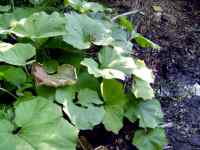
9. Herbaceous vegetation: Tall herbaceous vegetation dominated by Petasites alba. This very broad leaf vegetation ensures temporary shelter for otters during the vegetation season. Otter footprints were found among this vegetation on the banks of Vacha River. |
|
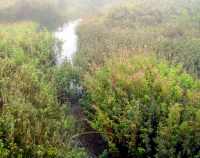
10. Herbaceous vegetation: Other tall herbaceous vegetation often dominanted by Mentha spp., Urtica spp., Sambucus spp. Otter tracks registered among such vegetation on Vacha, Chaya and Parvenetzka Rivers, and Golyam Beglik Dam. Using of this habitat in mountainous regions was also registered in Stara Planina Mountain (area Uzana). |
|
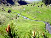
11. Herbaceous vegetation: Short grass vegetation as high mountain pasture lands and meadows. Rarely used by otters, because this habitat does not provide shelter. Feeding on crayfish in small mountain rivers surrounded by this habitat type was rarely recorded in Rhodopes and also in Stara Planina Mountains (area Uzana). Habitat code 6520. |
|
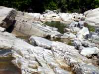
12. Rocky banks sometimes with hazmophyt herbaceous vegetation. In the Rhodopes Mountain the rocks were often used as otters’ holts (for example at Chaya River). The stones were also the commonest substrates for sprainting. Habitat codes 8210 and 8220. |
|
ACKNOWLEDGMENTS - We thank Prof. Chris Mason, Dr. Arno Gutleb, Dr. Lene Jacobsen, Dr. Hugh Jansman, Dr. Lukas Polednik and Prof. Laura Bonesi for their friendly support and valued advice at the beginning of the otter investigations in Bulgaria in 2005. We also thank to Prof. Nikolai Spassov, Yanislav Yanchev, Sirma Zidarova and Yordan Koshev for personal communications and for their own conservation activities for otters in the country. We thank and to Mladen Angelov (NGO Green Balkans) for the map material.
REFERENCES
CHANIN P. (2003). Ecology of the European Otter. Conserving Natura 2000 Rivers Ecology Series № 10, English Nature, Peterborough, 64 pp.
DURBIN L. (1996). Individual differences in spatial utilization of a river-system by otters Lutra lutra. Acta Theriol. 41: 137-147.
ERLINGE S. (1967). Home range of the otter Lutra lutra L. in Southern Sweden. Oikos 18: 186-209.
ERLINGE S. (1968). Territoriality of the otter Lutra lutra L. Oikos 19: 81-98.
GANEVA A., RUSAKOVA, V., GOGUSHEV, G., DINITROV, M., JELEV, P., IVANOV, P., CONEV, R., IVANOVA, T., BELEV. T. & GUSEV, C. (2005). A guide for habitats with an European importance in Bulgaria. WWF, Green Balkans, Sofia, 128 pp. [in Bulgarian].
GEORGIEV D. (2005). Habitats of the otter (Lutra lutra L.) in some regions of Southern Bulgaria. IUCN Otter Spec. Group Bull. 22: 6-13.
GREEN J., GREEN, R. & JEFFERIES, D. (1984). A radio-tracking survey of otters Lutra lutra on a Perthshire river system. Lutra 27: 85-145.
JENKINS D. (1980). Ecology of otters in northern Scotland. I. Otter (Lutra lutra) breeding and dispersion in mid-Deeside, Aberdeenshire, in 1974–79. J. Anim. Ecol. 49: 713–35.
KRUUK H. (1995). Wild otters: Predation and populations. Oxford University Press, Oxford.
LILES G. (2003). Otter breeding sites: Conservation and Management. Conserving Natura 2000 Rivers Conservation Techniques, Series №5, English Nature, Peterbourgh.
MACDONALD S. & MASON, C. (1982). Otters in Greece. Oryx 16: 240-244.
MACDONALD S., MASON, C. (1985). Otters, their habitat and Conservation in Northeast Greece. Biol. Cons. 31: 191-210.
MASON C. & MACDONALD, S. (1986). Otters: ecology and conservation. Cambridge University Press, Cambridge, 236 pp.
OTTINO P. & GILLER, P. (2004). Distribution, density, diet and habitat use of the otter in relation to land use in the Araglin valley, Southern Ireland. Biology and Environment, Proc. Royal Irish Acad. 104B: 1-17.
PESHEV TS., PESHEV, D. & POPOV, V. (2004). Fauna Bulgarica: Mammalia. Marin Drinov Acad. Publ. 27: 632 pp. [In Bulgarian].
RUIZ-OLMO J., JIMENES, J. & LOPEZ-MARTIN, J. (1995). Radio-tracking of otters Lutra lutra in north-eastern Spain. Lutra 38: 11-21.
SIDOROVICH V. (1991). Structure, reproductive status and dynamics of the otter population in Byelorussia. Acta Theriol. 36: 153-161.
SIDOROVICH V. (1995). Minks, otters, weasel and other mustelids. Minsk, Uradjai Publ., 190 pp. [in Russian].
SPIRIDONOV G. & MILEVA, L. (1994). The status of the otter (Lutra lutra) in Bulgaria. In: Seminar on the Conservation of the European Otter (Lutra lutra), Leeuwarden, the Netherlands, 7-11 June 1994, Council of Europe, Strasbourg, 77-80.
SPIRIDONOV G. & SPASSOV, N. (1989). The otter (Lutra lutra L., 1758) in Bulgaria, its state and conservation. Hist. Natural. Bulg. 1: 57-63.
VSHIVCEV V. (1967). On the biology and using of the river otter in Sahalin. Collection of Scientific and Technological Information. Kirov 22: 12-22. [In Russian]
Previous | Contents | Next
|


